O16/010
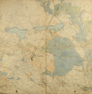
HAND COLOURED MAP OF VALTICE REGION (LEDNICE, LADNÁ, REINTHAL)
2nd half of the 19th century
Hand coloured map of Valtice Region (Lednice, Ladná, Reinthal), printed on paper, mounted on textile. Print area 257x260 mm. 515x522 mm. Scale 1:28 800. Comes with:
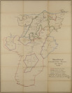
Hand painted map of Kaprun hunting district. "Übersichtskarte des hochfürstlichen Kapruner Jagd-Revieres". 620x800 mm, paper mounted on textile. Scale 1:28 800. Comes with:
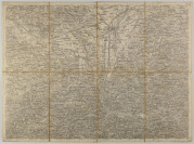
Mürzzuschlag and St. Pölten, two map sheets from work Artarias General - Karten Österreichisch-ungarischen Länder. Steel engraving on paper mounted on textile. Scale 1: 75 000.


 Czech
Czech English
 German


 Loading higher resolution